Details and Metadata
Printer-friendly version View XML version Download Ecological Metadata Language file
Methods
The methods followed in the creation of the dataset, including description of field, laboratory and processing steps, and quality control procedures
Past Methods (No longer in use)
- Recharge sampling
Started: 1995-06-01
Ended: 1996-12-31Precipitation samples collected weekly from 16 stations in the area are used to monitor isotopic composition of recharge to groundwater. Water samples are measured for delta 18 O composition.
- Oxygen isotopic composition sampling
Started: 1995-06-01
Ended: 1996-12-31Eight wells are sampled and analyzed for delta 18 O composition. Continued isotopic analysis of groundwater samples provides a means for detecting the altitudinal and seasonal isotope signatures in the bedrock groundwater system to compare with precipitation signitures. This information is used to identify upper elevation areas of recharge and determine travel rates from the recharge zones to lower elevations.
- Oxygen isotopic analysis
Started: 1995-06-01
Ended: 1996-12-31Over 1000 samples were collected for oxygen isotopic composition and analyzed at the University of Vermont's Stable Isotope lab.
Instrumentation: VG SIRA Series II Isotope Ratio Mass Spectrometer
Quality Control Measures: Normalized to values obtained for standards
Dataset Fields
Detailed documentation of the fields comprising the dataset, including the type of measurement, units where applicable, and any controlled vocabularies or code lists present in the data
| Field Name | Caption | Description | Additional Information |
|---|---|---|---|
| Round | Round | Unique round ID | Nominal |
| Date | Date | Date | DateTime Date/Time Format: YYYY-MM-DDThh:mm:ss |
| P1 (Rain) | Rain Measurement at Site 1 | O-18 Rain measurement at site 1 | Ratio Unit: percent Precision: 0.001 |
| C1 (Snow) | Snow Measurement at Site 1 | O-18 Snow measurement at site 1 | Ratio Unit: percent Precision: 0.001 |
| P2 (Rain) | Rain Measurement at Site 2 | O-18 Rain measurement at site 2 | Ratio Unit: percent Precision: 0.001 |
| P3 (Snow) | Snow Measurement at Site 3 | O-18 Snow measurement at site 3 | Ratio Unit: percent Precision: 0.001 |
| P4 (Rain) | Rain Measurement at Site 4 | O-18 Rain measurement at site 4 | Ratio Unit: percent Precision: 0.001 |
| M4 (Melt) | Melt Measurement at Site 4 | O-18 Melt measurement at site 4 | Ratio Unit: percent Precision: 0.001 |
| C4 (Snow) | Snow Measurement at Site 4 | O-18 Snow measurement at site 4 | Ratio Unit: percent Precision: 0.001 |
| P6 (Rain) | Rain Measurement at Site 6 | O-18 Rain measurement at site 6 | Ratio Unit: percent Precision: 0.001 |
| M6 (Melt) | Melt Measurement at Site 6 | O-18 Melt measurement at site 6 | Ratio Unit: percent Precision: 0.001 |
| C6 (Snow) | Snow Measurement at Site 6 | O-18 Snow measurement at site 6 | Ratio Unit: percent Precision: 0.001 |
| CC6 (Pack) | Pack Measurement at Site 6 | O-18 Pack measurement at site 6 | Ratio Unit: percent Precision: 0.001 |
| P7 (Rain) | Rain Measurement at Site 7 | O-18 Rain measurement at site 7 | Ratio Unit: percent Precision: 0.001 |
| M7 (Melt) | Melt Measuremet at Site 7 | O-18 Melt measuremet at site 7 | Ratio Unit: percent Precision: 0.001 |
| C7 (Snow) | Snow Measurement at Site 7 | O-18 Snow measurement at site 7 | Ratio Unit: percent Precision: 0.001 |
| P8 (Rain) | Rain Measurement at Site 8 | O-18 Rain measurement at site 8 | Ratio Unit: percent Precision: 0.001 |
| M8 (Melt) | Melt Measurement at Site 8 | O-18 Melt measurement at site 8 | Ratio Unit: percent Precision: 0.001 |
| C8 (Snow) | Snow Measurement at Site 8 | O-18 Snow measurement at site 8 | Ratio Unit: percent Precision: 0.001 |
| CC8 (Pack) | Pack Measurement at Site 8 | O-18 Pack measurement at site 8 | Ratio Unit: percent Precision: 0.001 |
| P9 (Rain) | Rain Measurement at Site 9 | O-18 Rain measurement at site 9 | Ratio Unit: percent Precision: 0.001 |
| GW1 | Groundwater Well 1 | O-18 Groundwater well 1 | Ratio Unit: percent Precision: 0.001 |
| GW2 | Groundwater Well 2 | O-18 Groundwater well 2 | Ratio Unit: percent Precision: 0.001 |
| GW3 | Groundwater Well 3 | O-18 Groundwater well 3 | Ratio Unit: percent Precision: 0.001 |
| GW4 | Groundwater Well 4 | O-18 Groundwater well 4 | Ratio Unit: percent Precision: 0.001 |
| GW5 | Groundwater Well 5 | O-18 Groundwater well 5 | Ratio Unit: percent Precision: 0.001 |
| GW6 | Groundwater Well 6 | O-18 Groundwater well 6 | Ratio Unit: percent Precision: 0.001 |
| GW7 | Groundwater Well 7 | O-18 Groundwater well 7 | Ratio Unit: percent Precision: 0.001 |
| GW7b | Groundwater Well 7b | O-18 Groundwater well 7b | Ratio Unit: percent Precision: 0.001 |
| GW8 | Groundwater Well 8 | O-18 Groundwater well 8 | Ratio Unit: percent Precision: 0.001 |
| GW9 | Groundwater Well 9 | O-18 Groundwater well 9 | Ratio Unit: percent Precision: 0.001 |
Sampling Equipment
Equipment and software used to collect data, including how that equipment was used.
No sampling equipment recorded for this dataset
Site Characteristics
The spatial extent of the dataset site coverage, and descriptions of the spatial extent and context for the data collection
- Site Description
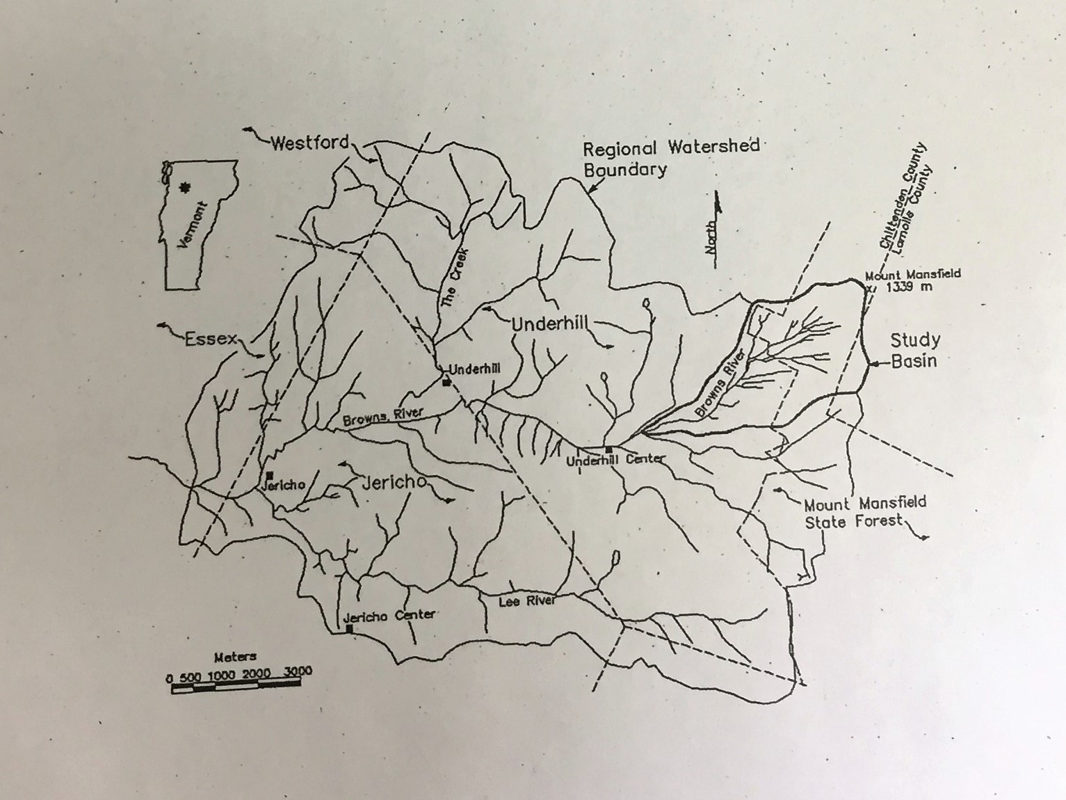
Uppermost basin of the Browns River including the slopes of Mt Mansfield. Stations at summit, Stevensville Brook and Browns River headwaters. Five sampling points on State Forest and UVM Natural Area, 3 additional sites in the VMC area on private lands. Additional sites throughout the basin.


 Details