Details and Metadata
Printer-friendly version View XML version Download Ecological Metadata Language file
Methods
The methods followed in the creation of the dataset, including description of field, laboratory and processing steps, and quality control procedures
Past Methods (No longer in use)
- Monitoring macroinvertebrates and diatoms
Started: 1999-08-01
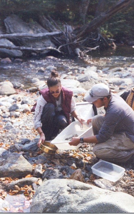
Ended: 2001-12-31For Methods for monitoring macroinvertebrates and diatoms: Macroinvertebrates collected according to protocol adapted from Karr and Chu 1999. Diatoms collected on introduced substrates (steriles), following method developed by A. Heidorn.
- Macroinvertebrate collection
Started: 2002-10-11
Ended: 2003-03-15For MacroInvertebrates as Water Quality Indicators: Collect macroinvertebrates from random confluence of 1st or 2nd order streams at 3 sites, using modified surber sampler. 5 samples will be collected from each site. Two sites will be on the Stowe side of Ranch Brook and West Branch; the third will be from the Spruce peak watershed.
- Macroinvertebrate re-sampling
Started: 2002-10-11
Ended: 2003-03-15For MacroInvertebrates as Water Quality Indicators: Re-sample from previous sites using conventional surber sampler and modified surber sampler.
- Digital mapping
Started: 2002-06-01
Ended: 2002-11-30For Digital Mapping of Paired Watersheds on Mt. Mansfield: Lewandowski will map stream channels on Mount Mansfield from June through November to create an accurate GIS layer.
- Geomorphological assessment of streams
Started: 2002-10-20
Ended: 2002-12-31For Geomorphological assessment of streams: Researchers will conduct a Phase 2 geomorphological assessment at 5 random locations on second order streams along the 1700' contour and 5 random locations on first order streams along the 2000' contour in each watershed, using Ausberger's macroinvertebrate study sites. Comparisons can be made between stream channel condition and macroinvertebrate species composition. Lewandowski subproject.
- Amphibian observations
Started: 2002-06-01
Ended: 2002-08-01For Amphibian species diversity: In this visual encounter survey researchers will walk the streams and record and photograph each amphibian observed w/in 1 meter of the stream bank. Rare, endangered or malformed amphibians will be photographed and their exact locations will be mapped.
Dataset Fields
Detailed documentation of the fields comprising the dataset, including the type of measurement, units where applicable, and any controlled vocabularies or code lists present in the data
No documentation available for these fields
Sampling Equipment
Equipment and software used to collect data, including how that equipment was used.
Past Sampling Equipment (No longer in use)
Surber sampler
Started: 2002-10-11
Ended: 2003-03-15conventional surber sampler and surber sampler modified by Sterling students
Site Characteristics
The spatial extent of the dataset site coverage, and descriptions of the spatial extent and context for the data collection
- Site Description
The West Branch (WB) watershed is 11.7 square kilometers and contains Stowe Mountain Resort, a ski area on Mount Mansfield in Stowe VT. The Ranch Brook (RB) watershed occupies the adjacent 9.6 square kilometers and is relatively undeveloped. RB is forested though it contains some cross country ski trails and a section of the mountain toll road. Approximately 20% of WB is taken up by manifestations of humans, including buildings, parking lots and roads.
Minimum Altitude: 1275 feet
Maximum Altitude: 1325 feet

