Forest Ecosystem Monitoring Cooperative
Formerly the Vermont Monitoring Cooperative
Log In
Advanced Search
  • Data
    Contribute DataFind DataCollectionsLive Meteorological DataData RescueAdditional Data ResourcesUser Guides
  • Monitoring
    Regional Forest Health MonitoringOther FEMC Monitoring
  • Tools & Products
    Tools & ProjectsPublications
  • Services
    Overview
  • Collaborate
    Annual MeetingEcosystem Monitoring FundJoin a project or state advisory committee
  • About FEMC
    OverviewStaffStrategic PlanOur DEIJ CommittmentJob OpportunitiesContact
Type
Monitoring project
Project Lead
Dan Dillner
Full details
Affiliation:
Vermont Department of Forests, Parks and Recreation, Vermont Agency of Natural Resources
Role:
Project Lead/Principal Investigator
Start Date:
2006-01-01
Contact Information:
E-mail: dan.dillner@vermont.gov
Work phone: (802) 879-5683
Barbara Schultz
Full details
Affiliation:
Vermont Department of Forests, Parks and Recreation, Vermont Agency of Natural Resources
Role:
Project Lead/Principal Investigator
Start Date:
1980-01-01
End Date:
2009-12-31
Contact Information:
E-mail: barbara.schultz@vermont.gov
Work phone: 8028858821
Contributing Organizations
Vermont Forest Parks and Recreation
Full details
Affiliation:
Vermont Department of Forests, Parks and Recreation, Vermont Agency of Natural Resources
Role:
Lead institution
Start Date:
1997-01-01
See all contributors
Project Citation
Dillner D., B. Schultz. 2017. Statewide Aerial Sketchmapping of Tree Defoliation, Mortality and other Damages. VT Department of Forests, Parks, & Recreation. FEMC. Can be found at: https://www.uvm.edu/femc/data/archive/project/statewide-aerial-sketchmapping-tree-defoliation-mortality
Links
  • USDA Forest Service Forest Health Protection, Mapping and Reporting Portal
  • Forest Health, Insects and Diseases reporting, Vermont Department of Forests, Parks and Recreation

Project

Vermont Statewide Aerial Sketchmapping of Tree Defoliation, Mortality and other Damages

  • Overview
  • Datasets
  • Contributors
  • Documents/Images

Project Overview

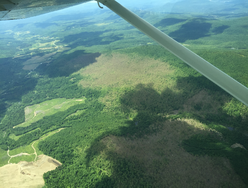
Aerial sketch mapping of defoliation, mortality, or other symptoms is a statewide survey conducted to detect tree damage, to determine its cause, and to maintain maps showing the location and extent of damage.

Dataset Availability

Downloadable: 5 datasets

See the full list of available data

Tags

  • Aerial Survey
  • Defoliation
  • Forest Disturbance
  • Tree Mortality

Status - Active

Start date: 1980-01-01

Anticipated end date: 2024-12-31

Study Area

Download Shapefiles
Loading...
Vermont Agency of Natural Resources logo Forest, Parks, and Recreation New York Department of Environmental Conservation Massachusetts Department of Conservation and Recreation New Hampshire Department of Natural and Cultural Resources US Forest Service logo UVM logo

FEMC © 2025 Vermont Econews
DataAbout FEMCMailing List
Contact us Find us on Facebook View us on Instagram