Details and Metadata
Printer-friendly version View XML version Download Ecological Metadata Language file
Methods
The methods followed in the creation of the dataset, including description of field, laboratory and processing steps, and quality control procedures
Current Methods
Meteorological data
Started: 2004-07-22The station provides near real-time monitoring for meteorological variables including wind speed and direction, air temperature, relative humidity, barometric pressure, precipitation and total solar irradiance. Data are automatically downloaded via radio frequency modem.
Dataset Fields
Detailed documentation of the fields comprising the dataset, including the type of measurement, units where applicable, and any controlled vocabularies or code lists present in the data
Field Name Caption Description Additional Information RECORDTIME Record Time Time and date of data collection
DateTime Date/Time Format: YYYY-MM-DD hh:mm:ss SAMPLEYEAR Sample Year Year of sample
DateTime Date/Time Format: YYYY SAMPLEMONTH Sample Month Month of sample
DateTime Date/Time Format: MM SAMPLEDAY Sample Day Day of year of the sample
Interval
Unit: day
Precision: 1SAMPLETIME Sample Time Time of data collection
DateTime Date/Time Format: hhmm AIRTEMP Air Temperature Measured air temperature
Interval
Unit: degree Celsius
Precision: 0.001RELHUMID Relative Humidity The amount of water vapor that is actually in the air, compared to how much water vapor potentially
Ratio Units: dimensionless
Precision: 0.01BAROPRESS Barometric Pressure Barometric pressure reading for atmospheric pressure
Ratio Units: millibar
Precision: 1PYRANOM Pyranometer Pyranometer reading of amount of solar irradiance
Ratio
Unit: watts per square meter
Precision: 0.01WATERTEMP Water Temperature Measured water temperature
Interval
Unit: degree Celsius
Precision: 0.01MAX_WINDSPEED Maximum Windspeed The fastest wind speed recorded in a 15 minute interval
Ratio
Unit: meters per second
Precision: 0.001TIME_MAX_WINDSPEED Time Maximum Windspeed Time of maximum windspeed recorded
DateTime Date/Time Format: hhmm MEAN_HORIZONTAL_WINDSPEED Mean Horizontal Windspeed The average speed of wind, regardless of its direction
Ratio
Unit: meters per second
Precision: 0.001MEAN_RESULTANT_WINDSPEED Mean Resultant Windspeed Wind speed normalized for its direction using a vector approach, this is vector averaged wind speed
Ratio
Unit: meters per second
Precision: 0.001MEAN_WIND_DIRECTION Mean Wind Direction Average direction of wind
Ratio
Unit: degree
Precision: 0.01STDDEV_WIND_DIRECTION Standard Deviation Wind Direction The standard deviation of the wind direction
Ratio
Unit: degree
Precision: 0.01PRECIP Precipitation Amount of precipitation
Ratio
Unit: millimeter
Precision: 0.01volt Volt Voltage reading
Ratio
Unit: volt
Precision: 0.01Sampling Equipment
Equipment and software used to collect data, including how that equipment was used.
Current Equipment
Data logger, meteorological sensors and cell
Started: 1998-10-01Campbell Scientific CR 10X datalogger with meteorological sensors and radio frequency modem.
Data logger, meterological sensors, radio fre
Started: 1998-10-01Campbell Scientific CR 10X datalogger with meteorological sensors and radio frequency modem.
Site Characteristics
The spatial extent of the dataset site coverage, and descriptions of the spatial extent and context for the data collection
- Site Description
The Diamond Island station is on the US Coast Guard Station navigational warning light tower on Lake Champlain (Lat: 44.2367, Long: -73.3329).
Minimum Altitude: 37 feet
Maximum Altitude: 52 feet
Dataset Notes
Notes describing any special conditions or considerations for understanding the quality and consistency of the data
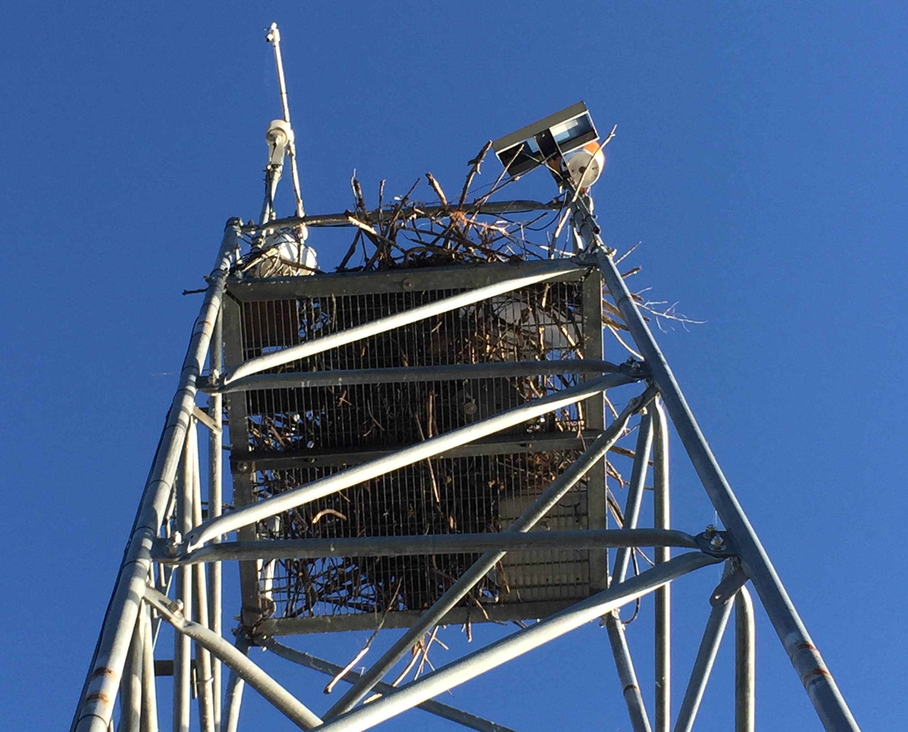
Start Date End Date Note Date Entered 2024-10-07 00:00:00 2024-10-07 23:59:59 Funding and maintenance of station switched from FEMC to SUNY Plattsburg - new station will be installed in spring 2025. All current sensors are working, but have not been recalibrated since they will be replaced by new equipment. Calibration was due 09/2023. Accuracy of data cannot be guaranteed past that date. 2024-10-07 13:32:31 2022-07-07 00:00:00 2022-07-07 23:59:59 New temp/RH sensor installed by LM 11am 2024-10-07 13:33:51 2021-09-17 00:00:00 2021-09-17 23:59:59 JT and AB visited site and performed maintenance. It was windy and sunny. We got to the island by boat with Marty from Basin Harbor. (Ferris was the contact) The datalogger was turned off at 9:56am. The temp sensor, BP sensor, pyranometer, wind vane and cup anemometer were replaced with calibrated sensors. Decided not to replace the battery. Recommended that ratchet straps are used to hold down the mast and a rope for pulling up supplies with the arm. 2022-09-19 09:10:35 2020-10-05 00:00:00 2020-10-05 23:59:59 JT and EG went out to DI to replace TempRH (A3510122) and BP (H1960039) with new temprh (B1240001) and bp (F2310008). The datalogger was turned off at 1113 and turned back on at 1222. The precip gage was cleaned out and the screen was placed back on. There was an old osprey nest at the site and it was removed. We couldn't use the pulley arm on the tower because it was too tall. Next time we will need to bring a 6-10" platform for someone around 5' 9" to reach the arm. Anyone shorter will need a taller platform, but that becomes dangerous because they get higher above the safety rail, not recommended. Should bring a large carabiner and chain to make it hang a little lower to ease hanging a block and tackle on. The program for DI was the same as the program launched in 2019 because the equipment is all the same. 2020-10-06 08:36:31 2019-10-29 00:00:00 2019-10-29 23:59:59 JD and ET. Turned off station power around 10:15. Installed the new battery (E96AB) and removed the old battery (#133). Installed the CR-1000x, attempted to power up with no terminals installed, same behavior of reading only 3.5 volts at the logger. Changed the power cable and tested, CR-1000x powered up. Re-installed each set of terminals and tested separately, no problems. Adjusted program to change RELHUMID variable name to RH_HC2S3 for value checking. Sent new program to the datalogger (I:\Administration\Met&AQ Monitoring Operations\Datalogger_Programs\DI\2019\20191028_DI_Program_Active.CR1X). Wired up 200M wind vane with constant power and tested that direction was working with the new program, checked out. Wind dir signal is wired into SE5. Wired up temp/RH for both H2SC3 (60947378) and HMP-45C (A3510122) to be panel switched and both were working. Both are wired into SW12_1 per the program. HC2S3 is wired with airtemp into SE13 and RH into SE14. Lowered mast, reinstalled the wind vane and restrung cables. Erected mast, cleaned up cables at the base, installed putty and went on our merry way. 2019-10-31 13:14:37 2019-10-25 00:00:00 2019-10-25 23:59:59 JT and JD went to troubleshoot wind vane issues at DI. TEMP/rh was also acting funny so we went and swapped out the temp rh (Z1050094) with temp/rh (A3510122). We also added another sensor with solar shied above the original one. This one is a model HC2S3 temp/rh. We are using this one as a backup. We also changed the wiring of the original temp/rh to a SW12. On the 200M wind vane we changed the red wire from VX2 to constant 5V. We were not able to see the results of this change up because the datalogger had stopped receiving power. We called campbell to find out that there a themal regulator within the datalogger that shuts off all power supplies to the datalogger to avoid a short circuit. The power from the battery terminals were fine but the power to the datalogger lingered around 3 V which was not enough to power up the sensors. We brought it back to the office and tested it with a backup power supply and the logger worked. We are going to bring a new battery on the next trip. 2019-10-25 15:09:51 2019-10-08 00:00:00 2019-10-08 23:59:59 JT and JD went out to DI to replace the CR10X data logger (24954), modem (6637), and radio (10256) with the new CR1000X (10859), RF500M (5295) and Ritron UHF radio (506329). Additionally we swapped out the temp/rh (F2450241) with temp/rh (Z1050094), NRG Anemometer (261120) with anemometer (198023), a wind vane (no SN) with wind vane (2344), bp sensor (L5210461) with new CS106 bp sensor (F2310008), and pyranometer (PY89042) with new pyranometer (PY59196). The site still needs a new battery, the one we brought out was DOA. Old battery should be good until December. We measured the height from the ground to the platform at the top corner as 10.3m. The height to the top of the temp/rh probe was ~12.91m. The wind sensors and pyranometer was ~14.91m, and the bp was ~10.76m. The light is measured at 11.27m by the USCG. The sensors need to be remeasured referencing the light. Additional information about our visit can be found in the DI folder on the idrive in the 20191008 visit folder. There were slight modifications done to the wiring diagram created by shortcut to match out CR10X wiring. The wires were labeled. The program for DI has been uploaded to idrive. While in the field we ran into a problem with the bp and py not reading correctly. For BP we changed the measurement rate to every scan and not hourly. For py we changed the multiplier provided by shortcut. It doesn't account for the millivolt adapter. We also did not jump the low cable to the ground. This is recommended by the campbell to stabilize the readings but not required. Will do next visit. 2019-10-14 11:32:43 2019-02-13 00:00:00 2019-02-13 23:59:59 In response to the note made on 2/7/19, the pyranometer data for DI was reviewed by JT. DI's pyranometer data was checked against Colchester Reef pyranometer data. Colchester reef was used as a comparison because of it's close proximity to DI. The comparison showed that there were no significant differences between DI and CR and the trends were normal throughout the years. We've reviewed the programs that handle the pyranometer readings and found that they were correct for the sensors (LI-Cor) we were using. We want to caution that the programs did have an error for the barometric pressure (BP) sensiors which was detected. We are currently in the process of back calculating and correcting the BP data. 2019-02-13 12:33:31 2019-02-07 00:00:00 2019-02-07 23:59:59 On 02/07/2019 Dr.Alan Betts using the pyranometer and BP data noted that there were some irregularities in the data. The Dr.Betts ran a comparison between pyranometer and BP readings to that of a lake model in ERA5. Comparisons showed that pyran readings from 2012 - 2018 were significantly lower than what ERA5 collected. This was the most apparent during the summer months. Dr. Betts also discovered that the BP readings from DI were sig different from that of ERA5 from 9/21/2016 to 12/1/2017. We discovered that during the period from 2015 to 9/21/2016 we were using an older model of the BP sensor (PTB101). On 9/21/2016 we went out to perform maintenance on the site which involved replacing the BP sensor with a newly calibrated sensor. We swapped out the old sensor with a newer model sensor (PTB110). However, when we made this switch we did not update the program within the datalogger. This resulted in the wrong offset being applied to the newly installed sensor. On 12/1/2017 we performed another maintenance visit to DI and we swapped the BP sensor back to the old sensor model and the data began to match local BP readings again until 8/14/2019 where we performed another maintenance visit and swapped the BP sensor back to the newer model where the program did not match up and the data was off again. Ultimately the BP readings are off at DI from 9/21/16 to 12/1/2017 and from 8/14/2018 to the current most current date. The data will be corrected. 2019-02-08 10:43:01 2018-08-14 00:00:00 2018-08-14 23:59:59 John and Danielle Ward (2018 FHM Intern) headed out to DI on 8/14/18 to replace BaroP sensor and TempRH probe. Power down at 10:25.Power back on at 11:05. BaroP sensor was removed first and swapped with BaroP (L5210461). TempRH was then replaced with tempRH (F2450241) by taking down main mast and leaning accross the platform. Mast was then set back and new desipak was set into control box. The tipping rain gauge was then cleaned out. The screen for the rain gauge is missing, need new one on next trip. Additionally the screws that are used to hold up the main mast should be replaced, many are rusted and/or stripped. Lastly, when the water is low be careful loading the boat into the water using the ramp, there is a steep 4 foot dropoff at the end. Have someone in the boat probing the ground to make sure the tires don't go off the ramp. BP readings have dropped from 1007 to 988 after swap out. 2018-08-14 14:21:46 2018-04-23 10:00:00 2018-04-23 12:00:00 JT and MF visited site to investigate why comms had been spotty, becoming absent, since January 2018. Antennae was oriented correctly and power was good. Determined that the radio was bad (appeared to be receiving power and rx/tx active, but replacing it allowed JD to connect remotely). JD was able to download all data except ~20 days worth from 3/1 @ 1:15 AM to 3/28 @ 11:30 AM that was overwritten. Weather was beautiful. A little skim ice on the lake, but sunny and no wind. Pro tip: stop by Dakin Farms on the way back for creemees so 1. you get a maple creemee and 2. you can guilt-free eat all the snacks!Weather was beautiful. A little skim ice on the lake, but sunny and no wind. Pro tip: stop by Dakin Farms on the way back for creemees so 1. you get a maple creemee and 2. you can guilt-free eat all the snacks! 2018-04-23 13:40:17 2018-04-23 00:00:00 2018-04-23 23:59:59 JT and MF visited site to investigate why comms had been spotty, becoming absent, since January 2018. Antennae was oriented correctly and power was good. Determined that the radio was bad (appeared to be receiving power and rx/tx active, but replacing it allowed JD to connect remotely). JD was able to download all data except ~20 days worth from 3/1 @ 1:15 AM to 3/28 @ 11:30 AM that was overwritten. Weather was beautiful. A little skim ice on the lake, but sunny and no wind. Pro tip: stop by Dakin Farms on the way back for creemees so 1. you get a maple creemee and 2. you can guilt-free eat all the snacks! 2018-04-23 13:32:46 2017-11-30 10:15:00 2017-11-30 12:00:00 Power off at 10:15 am. Replaced Temperature/ RH sensor, Barometric P Sensor, Cup Anemometer, Wind Vane, Battery (Only 1 battery at this site), and the pyranometer. Serial numbers for the new equipment: Temp/RH (F5030027), Barometric P Sensor (R130015), Cup Anemometer (1795-00261120), Wind Vane (PN1799), Battery ( SRM27600CCA750MCA-1), Pyranometer (89042). Precipitation gauge was checked, installed new mesh screen and placed 4 rocks on top to hold it down. 2018-01-08 11:16:02 2017-11-30 00:00:00 2017-11-30 23:59:59 Power off at 10:15 am. Replaced Temperature/ RH sensor, Barometric P Sensor, Cup Anemometer, Wind Vane, Battery (Only 1 battery at this site), and the pyranometer. Serial numbers for the new equipment: Temp/RH (F5030027), Barometric P Sensor (R130015), Cup Anemometer (1795-00261120), Wind Vane (PN1799), Battery ( SRM27600CCA750MCA-1), Pyranometer (89042). Precipitation gauge was checked, installed new mesh screen and placed 4 rocks on top to hold it down. 2017-12-04 14:11:02 2012-08-24 12:00:00 2012-08-24 12:30:00 went to tower. Osprey and nest in tower so we couldn't access it. 2012-08-28 00:00:00 2010-10-15 00:00:00 2011-11-02 00:00:00 Water Temp sensor stopped working, will not be replaced this fall, 2010-11-18 00:00:00 2009-11-10 00:00:00 0000-00-00 00:00:00 rain guage closed for winter 2010-05-14 08:33:00 2009-09-24 10:15:00 2010-10-03 11:00:00 unexpected data loss, corrected for DI, not CR 2010-05-14 08:31:00 2008-09-23 09:30:00 2009-07-15 08:00:00 Rain guage closed for winter 2009-07-28 16:31:00 2008-06-16 08:45:00 2008-06-16 10:00:00 Records lost due to power loss during equipment change. 2008-06-18 10:39:00 2007-10-30 10:30:00 2008-06-16 10:15:00 Rain gage closed for the winter 2008-01-17 16:30:00 2006-10-09 00:00:00 2007-06-21 09:00:00 Tipping bucket (rain gage) covered for season 9 Oct 2006 2007-10-22 00:00:00 2006-09-07 09:00:00 2006-09-07 11:15:00 Station taken off-line for instrument change 0900-1115 EST Sept 7 2006 2007-10-15 00:00:00 2006-07-12 23:15:00 2006-07-13 06:45:00 Data missing for unknown reasons 2007-10-22 00:00:00 2005-12-30 00:00:00 2005-12-31 05:00:00 Data overwritten approx 12/30 1200-2400 and 12/31 0000-0500 2005 2007-10-15 00:00:00 2005-12-30 00:00:00 2005-12-31 00:00:00 Changed air temperature/relative humidity & barometric pressure sensors for calibration purposes 2008-02-08 16:01:00 2005-10-20 11:30:00 2006-05-26 10:00:00 Tipping bucket (rain gage) covered for season at @10:30 AM DST 20 Oct 2005 (11:30 EST), Tipping bucket (rain gage) opened approximately 10 a.m. EST 26 May 2006. 2007-10-22 00:00:00 2004-09-24 09:45:00 2005-05-09 09:30:00 Tipping bucket (rain gage) covered for season at 0945 AM 24 Sept 2004, Tipping bucket (rain gage) opened approximately 10 a.m. EST 9 May 2005. Nullfiy false tips at 9:15 and 9:30 2007-02-13 16:26:00 1998-10-21 08:45:00 1999-05-03 11:30:00 Data missing for unknown reasons 2007-10-22 00:00:00 0000-00-00 00:00:00 0000-00-00 00:00:00 Sensors are *not* heated during the winter. 2008-01-09 14:35:00